![]()
Data visualization on plan view and 3D modeling
View and analyze your data
Site is used to view and locate sites, borings and axes on a 2D plan view with Google Maps and topographic maps. With Site, you can prepare investigation campaigns and create 3D data terrain models.
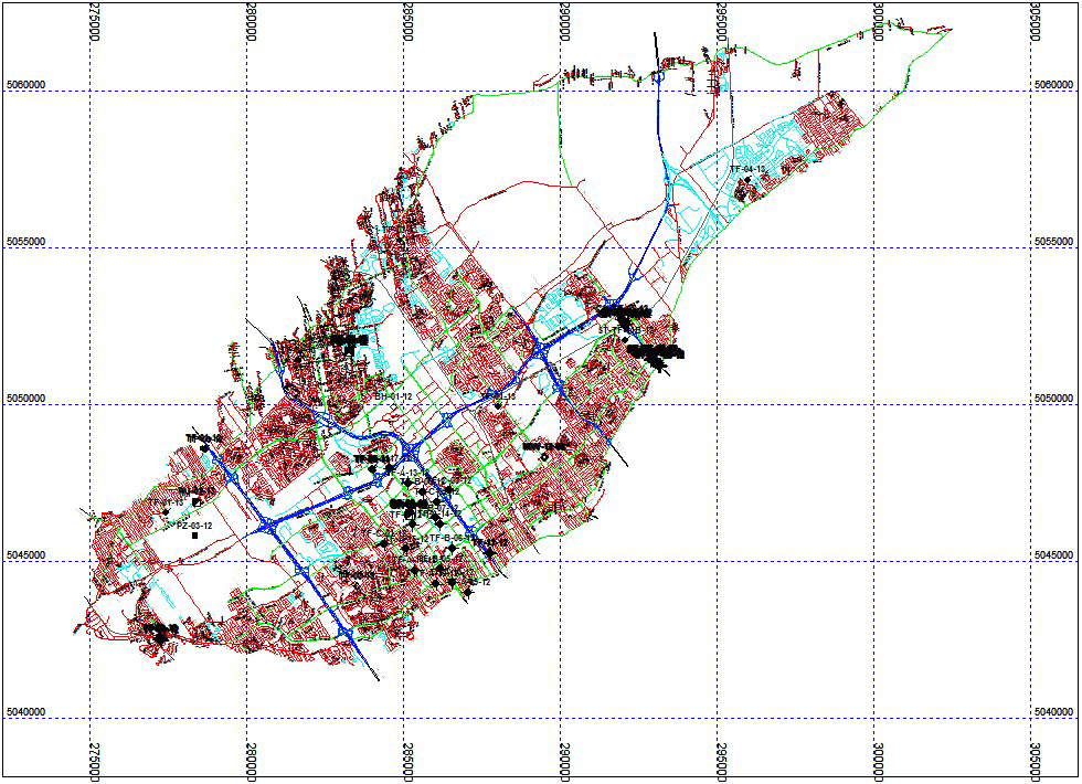
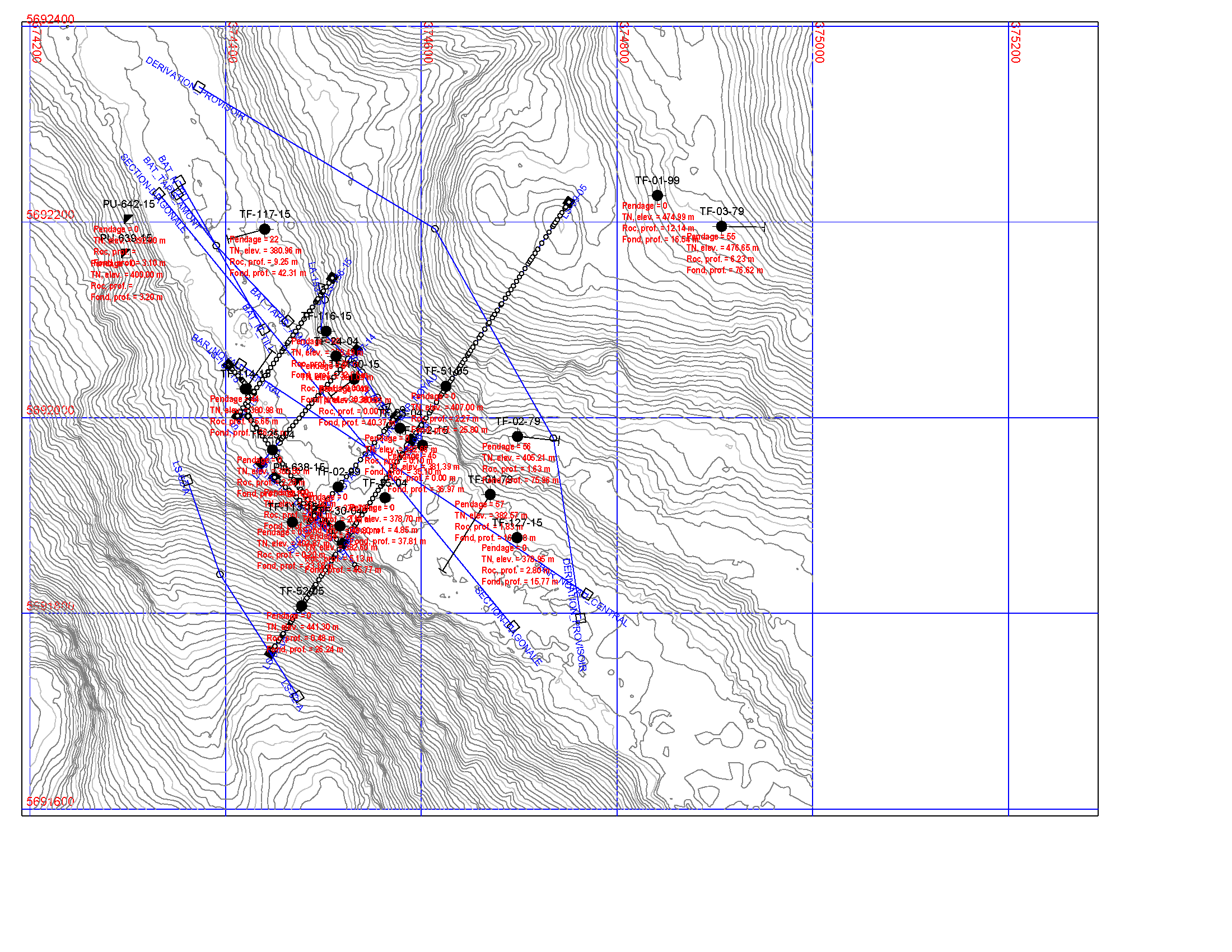
- Plan view showing sites, borings and axes over topographic map
- Plan view on Google Maps
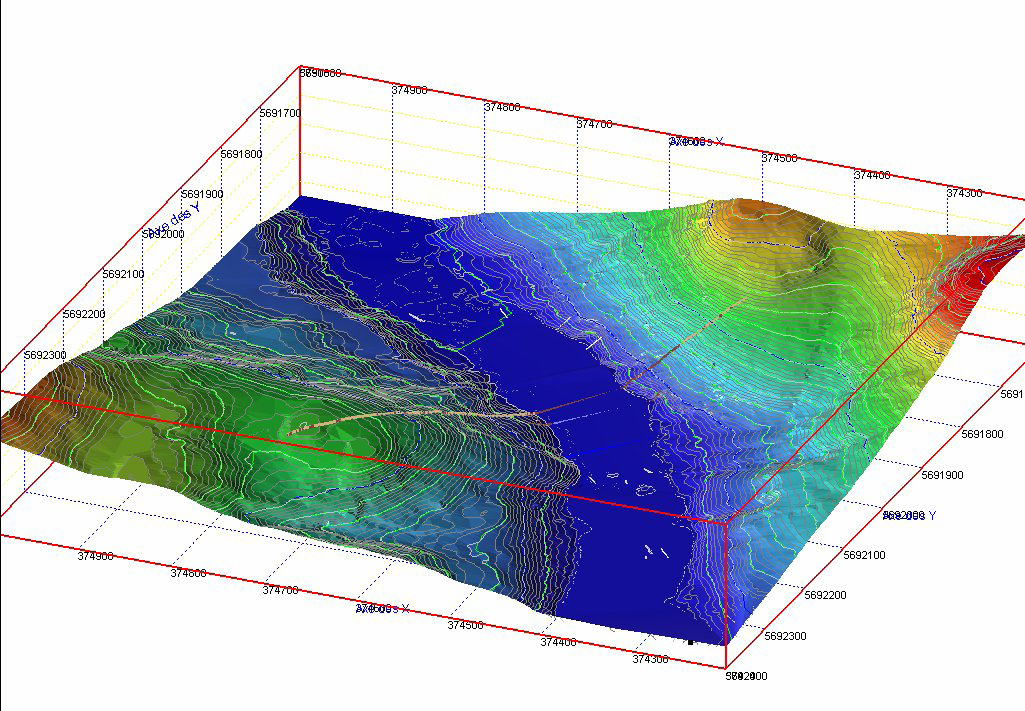
- Representation of borings properties in 3D
- Production of IGES files for CATIA
- Export of borings points in DXF format
- Supported files: AutoCAD .dxf, Global Mapper .dem, cartographic .sit, contours .ctr, Surfer .grd, terrain models .dtm, kriged .k2d, triangulated .tin, IGES .igs
- Re-use the graphic presentations, independent from data, for any project

Geotechnical data
- Launch other modules via the plan view to query a site, boring or axis
- Display specific information under each boring point
- Symbols representative of types of borings and axes
- Interactive creation of axes and borings
- Interactive creation of rectangular or polygonal limits for data selection
- Support of OpenGL mode for cylinders of geotechnical properties
- Preparation and cost estimate of campaigns
- Estimate of rock surface based on borehole information

Site mapping and modeling
- Interactive editing of cartographic entities
- Maps editing as to the data domain
- Layer management of a cartographic file
- Operations of kriging and triangulation
- Creation of data terrain models (DTM) from kriged or triangulated files
- Mathematical operations on DTMs
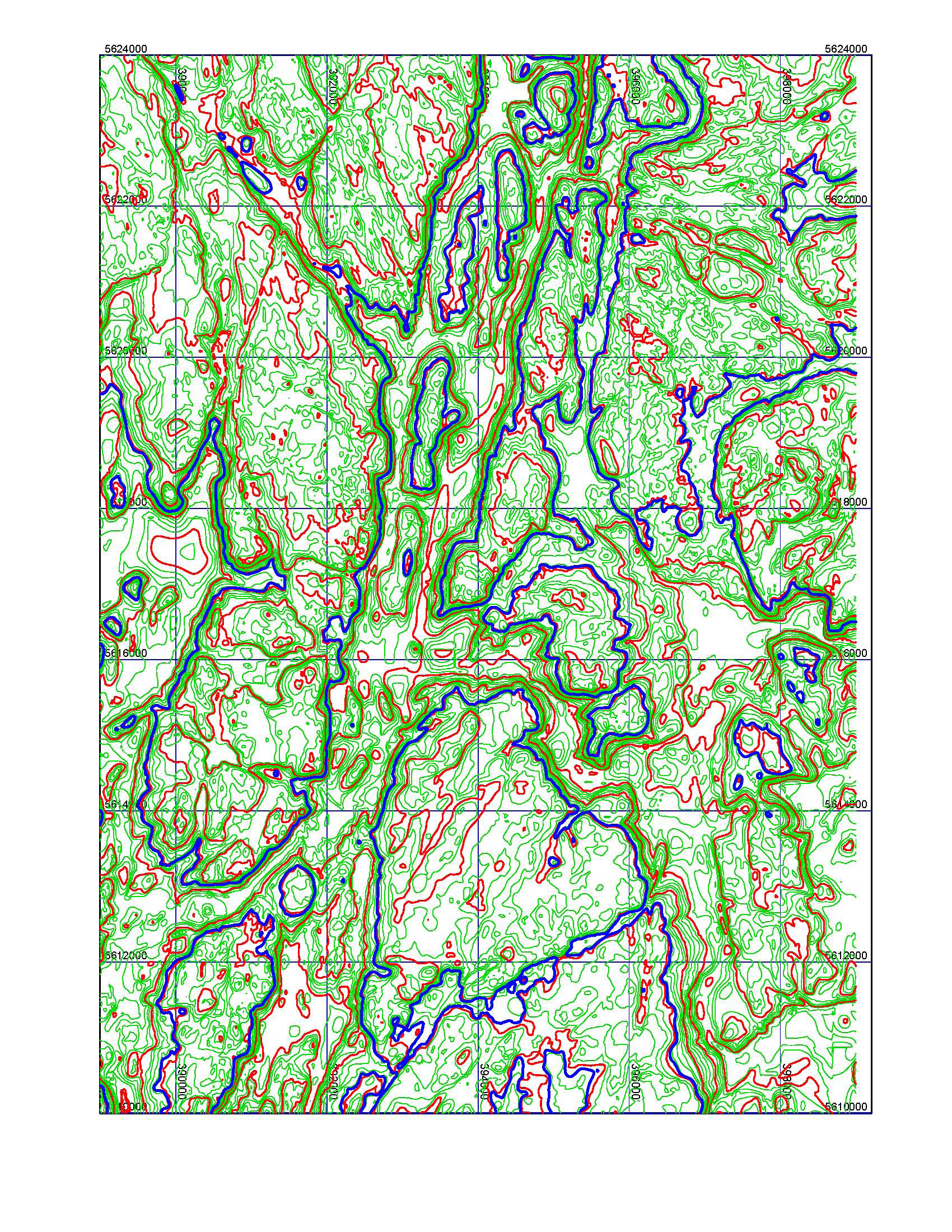
- Calculation of isovalue contours
- Volume calculation by elevation or between two surfaces
