![]()
Field application for borehole data entry
Why choose Geotab?
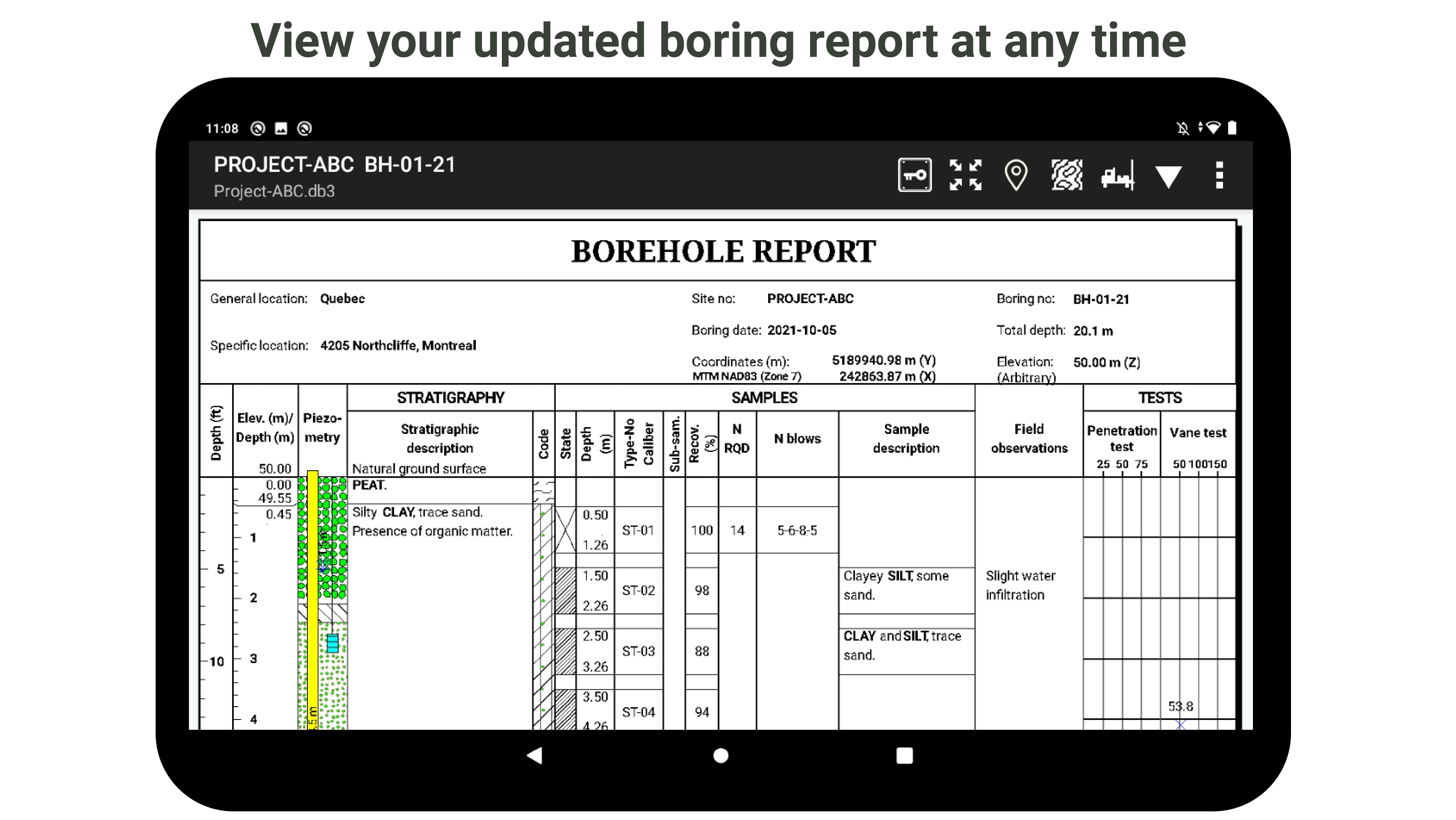
Geotab is a tool for collecting borehole data directly on the field and viewing preliminary borehole reports.
- Data entry directly in the field -> no transcription at the office
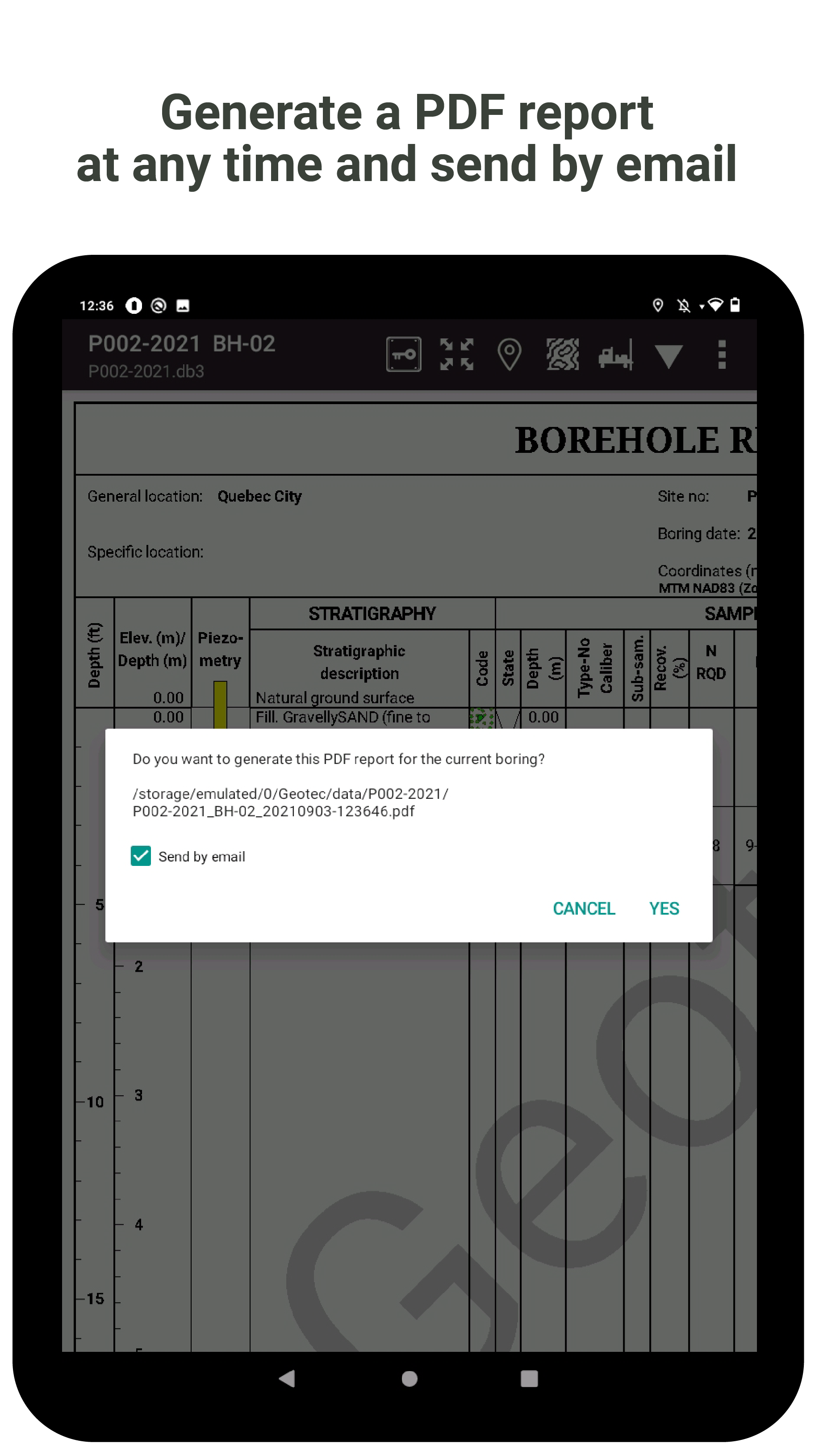
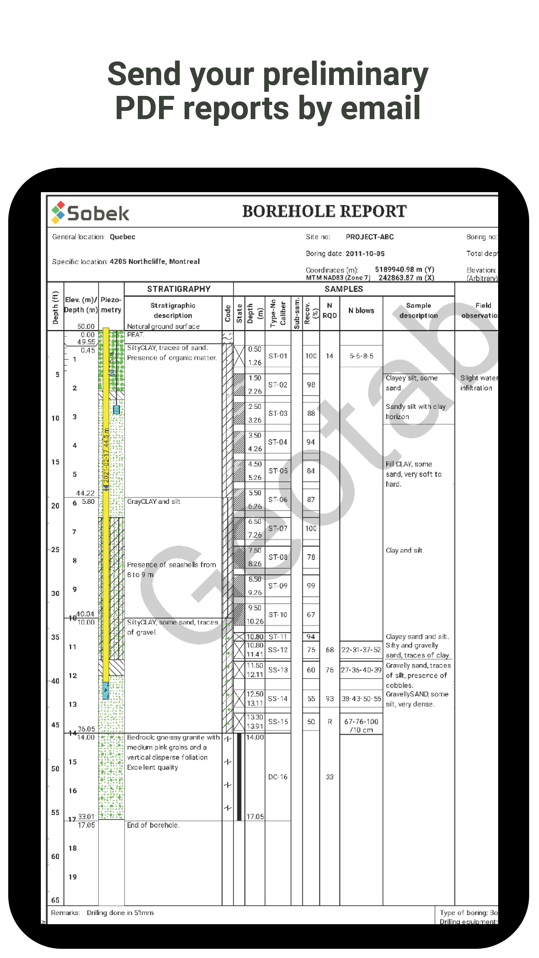
- Borehole report preview for immediate validation
- Consistency of data input across all field staff and projects
- Quick and easy data transmission to the office or the client
- Compatible with Geotec on Windows for further analysis
- Bilingual application (English and French)

Entry features
Geotab was designed for fast and comprehensive data entry.
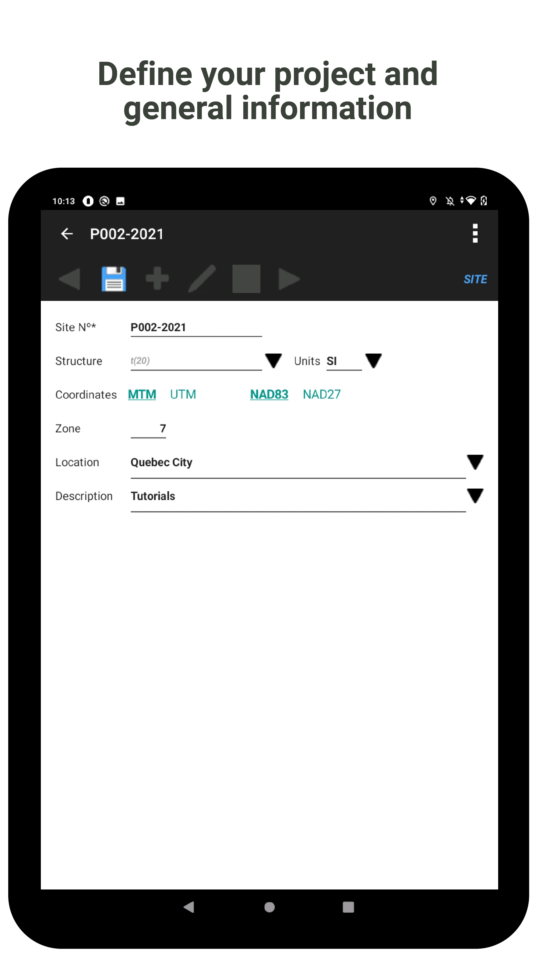
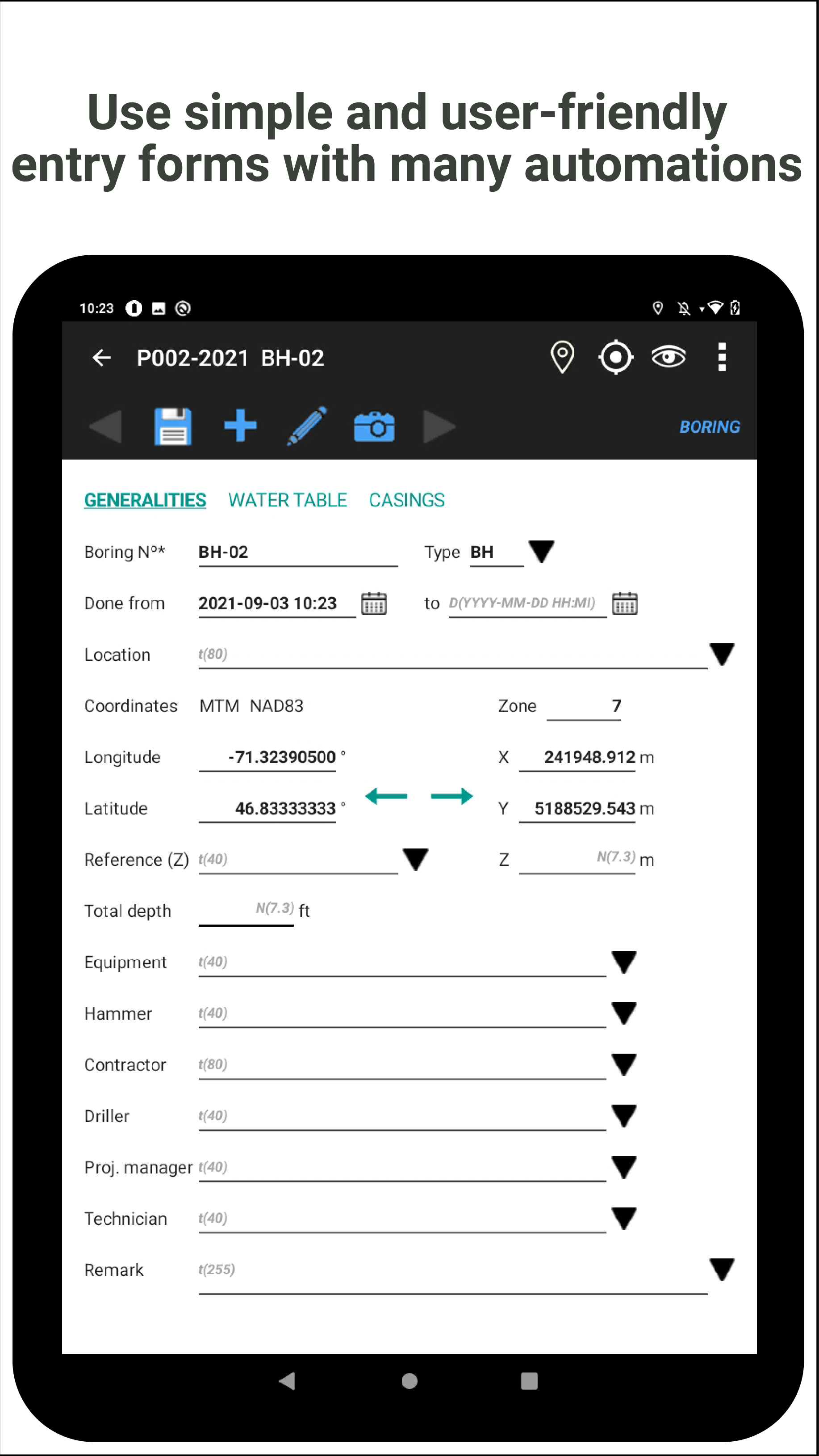
- Simple, user-friendly and customizable entry forms
- Data entry workflow based on field work
- Several default values, automations and calculations
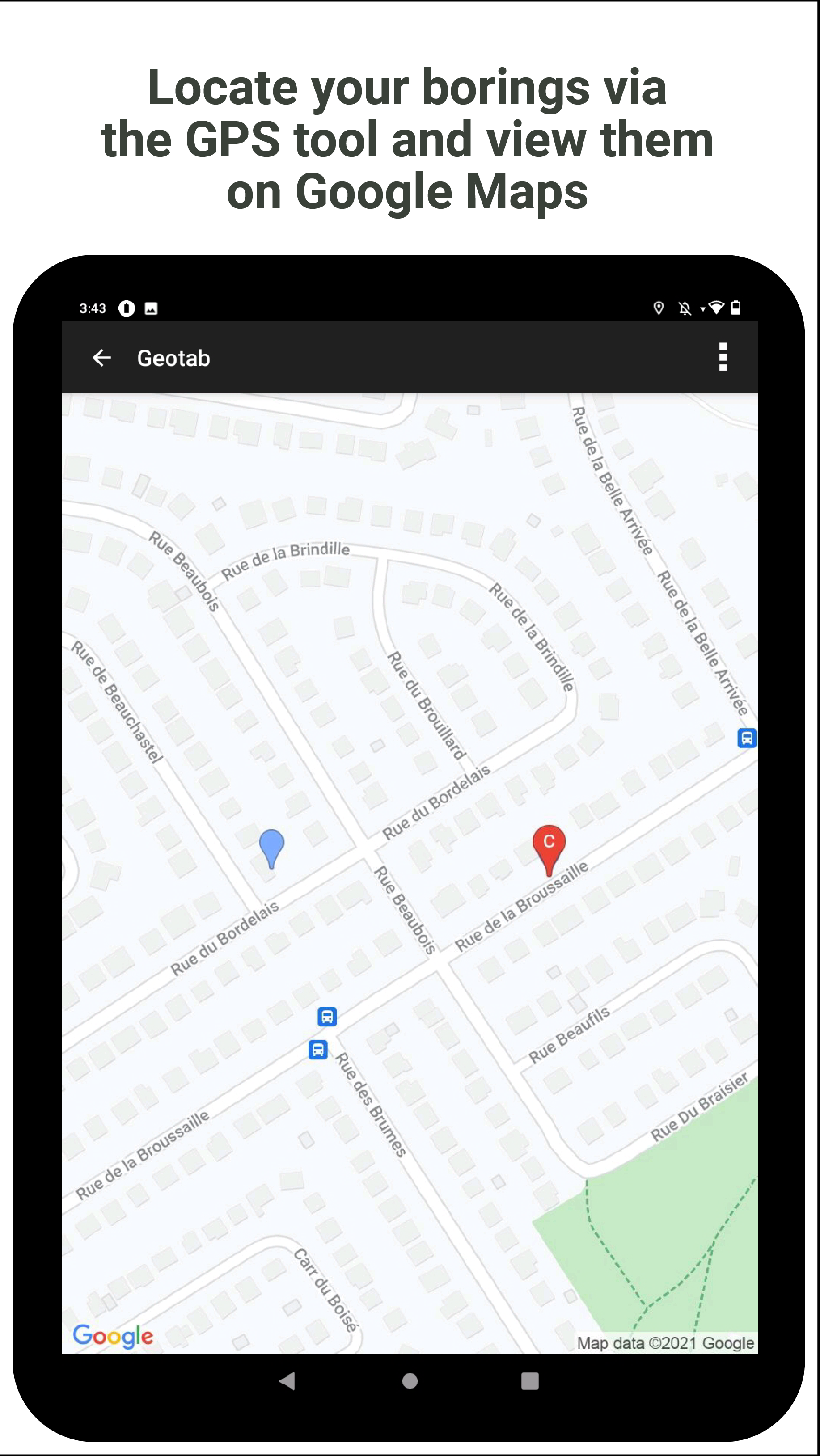
- GPS location and Google map
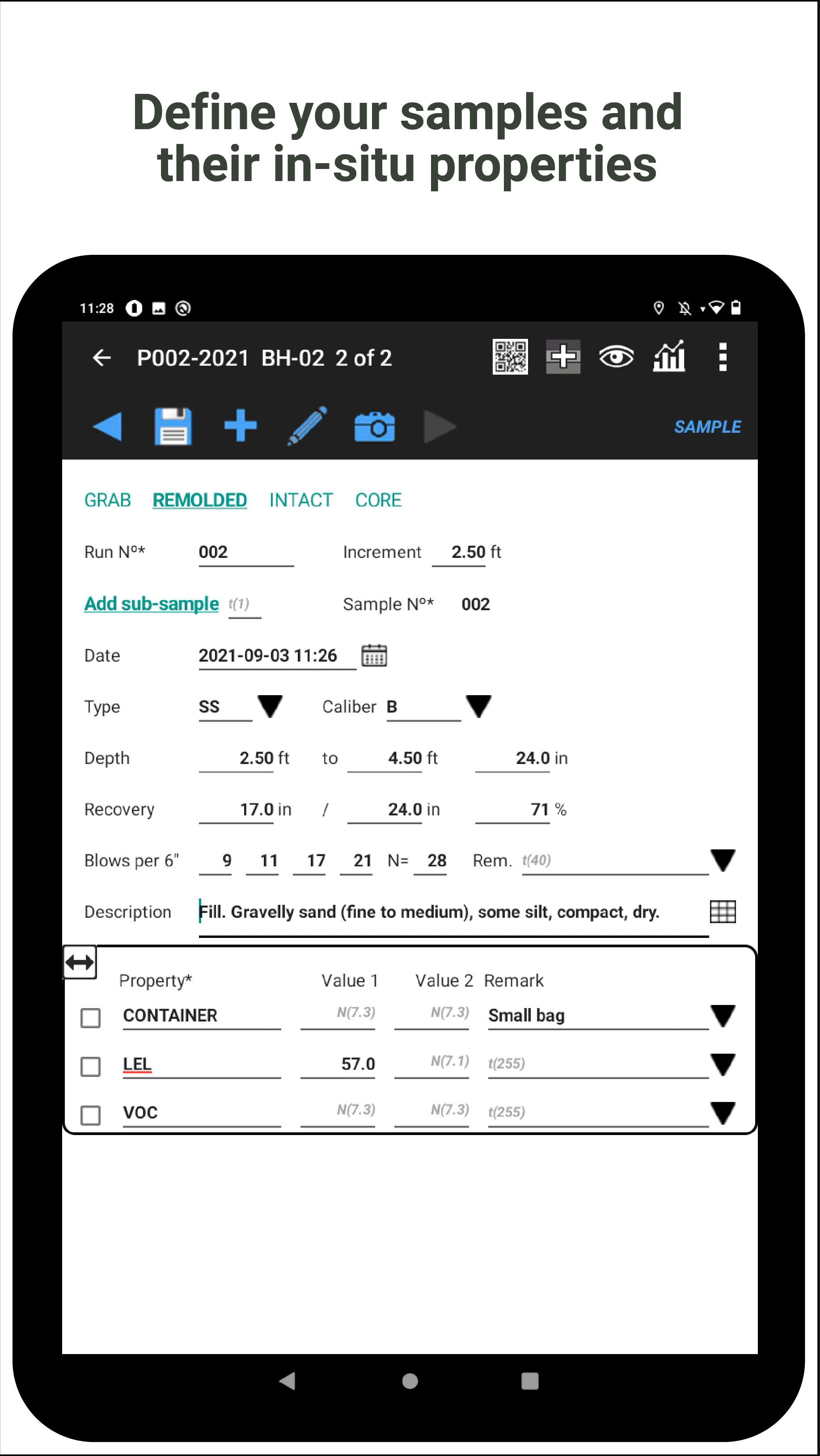
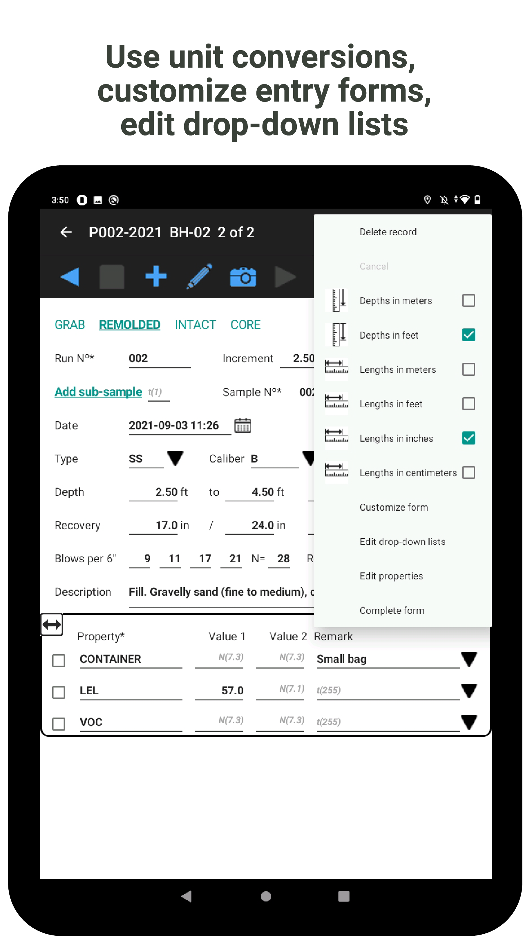
- Use of metric and imperial units (m, ft, in, cm)
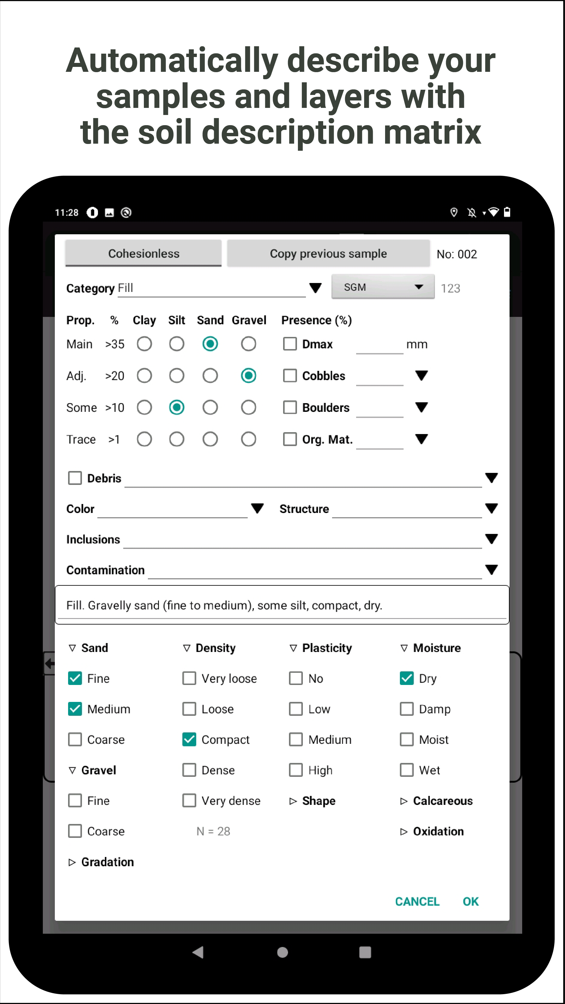
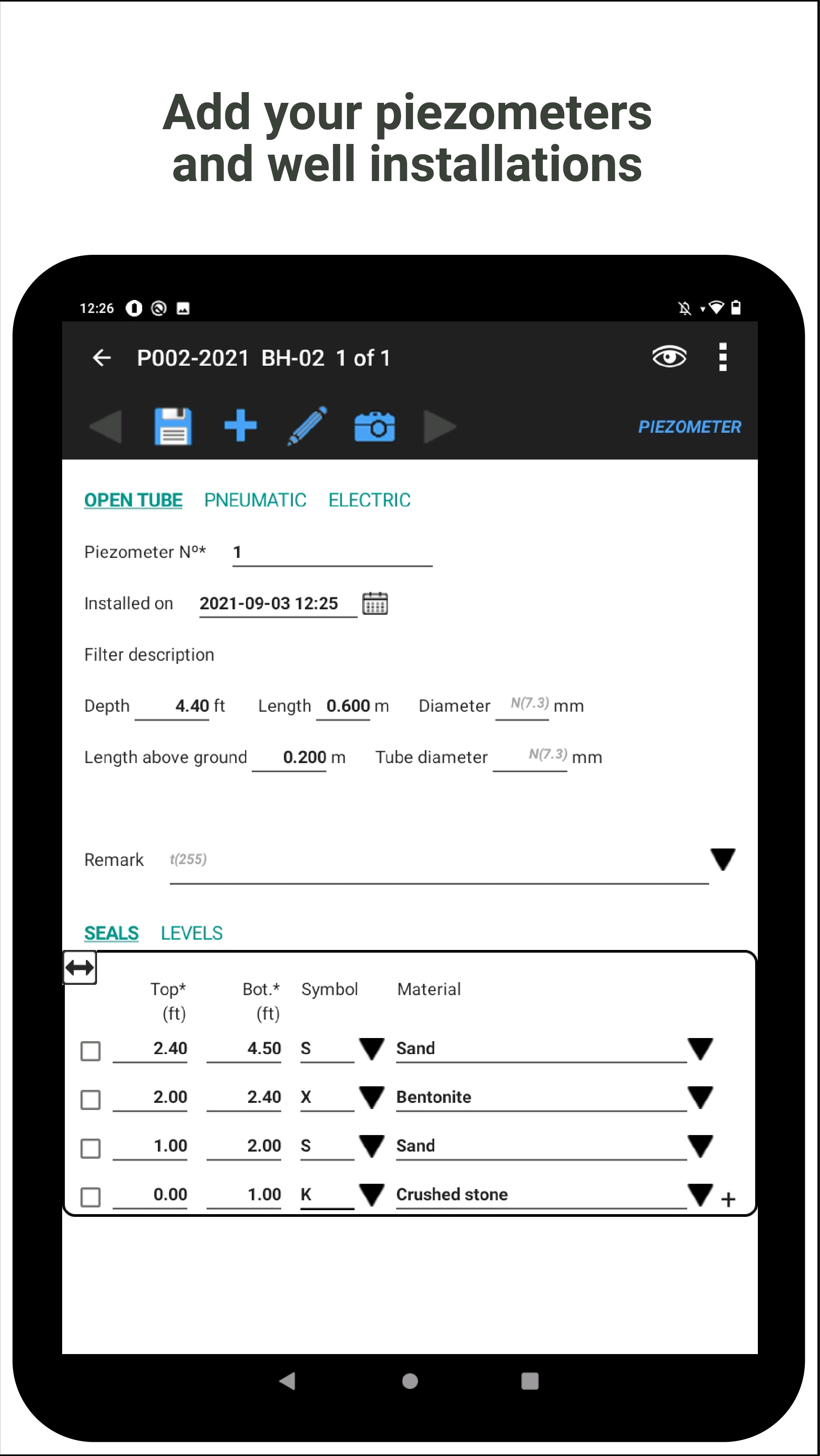
- Description of soils via a matrix with elements to check
- Layers created by combining samples
- Description of sub-samples
- Photos and sketches


Management features
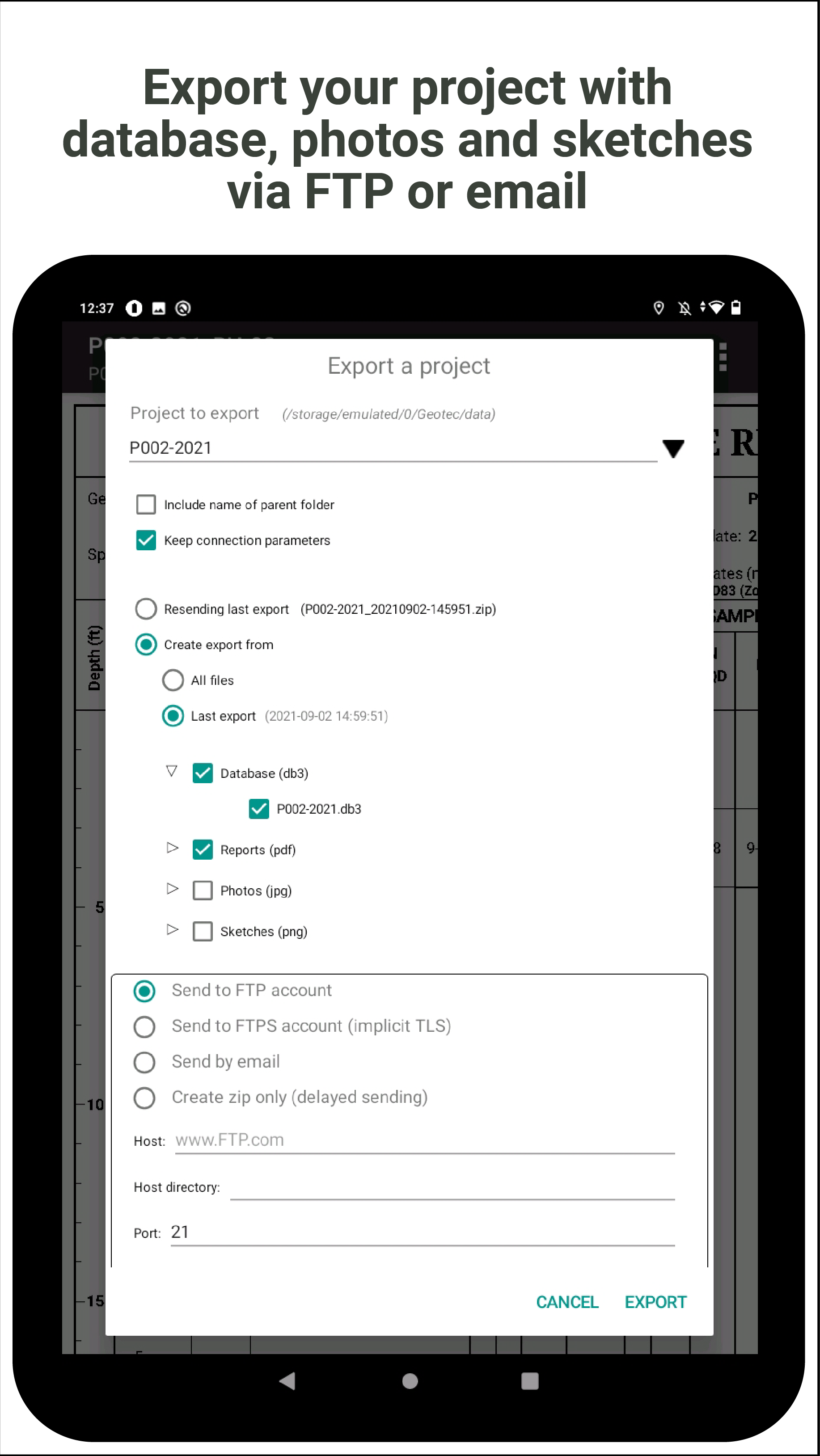
Geotab allows you to work offline. Projects are saved in the tablet and available to the users. When Internet is available, projects can be sent to the office or the client.
With Geotab, you can create a template database with customized entry forms and drop-down lists to optimize the process.
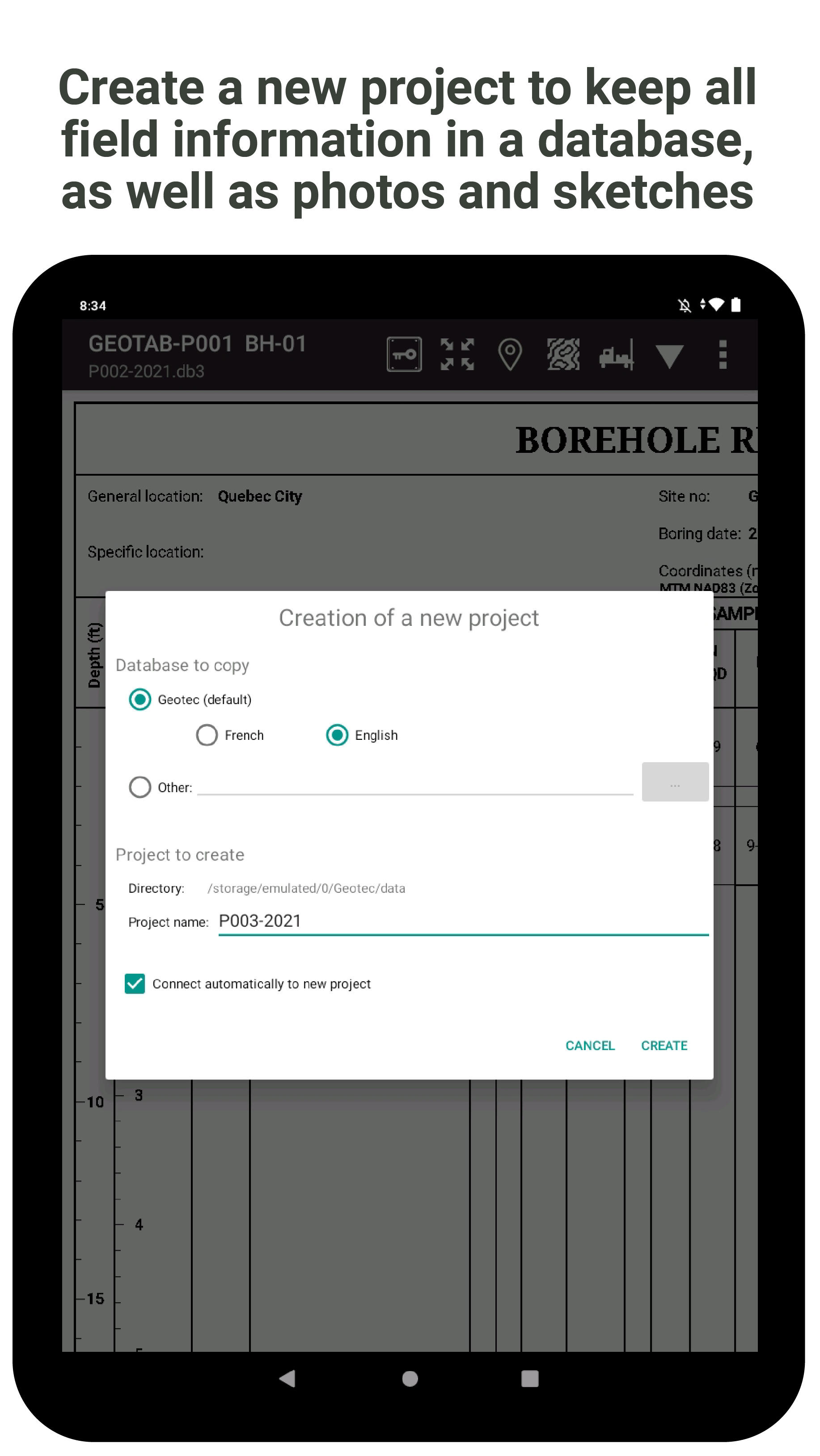
- New folder generated for each project, with a database, photos, sketches and PDFs created
- Creation of new project from a template database with customized entry forms and drop-down lists
- Production of PDF borehole reports to send by email
- Tool to export projects via FTP, FTPs or email
