Our videos are designed to help you learn more about the various features of Geotec.
Getting Started
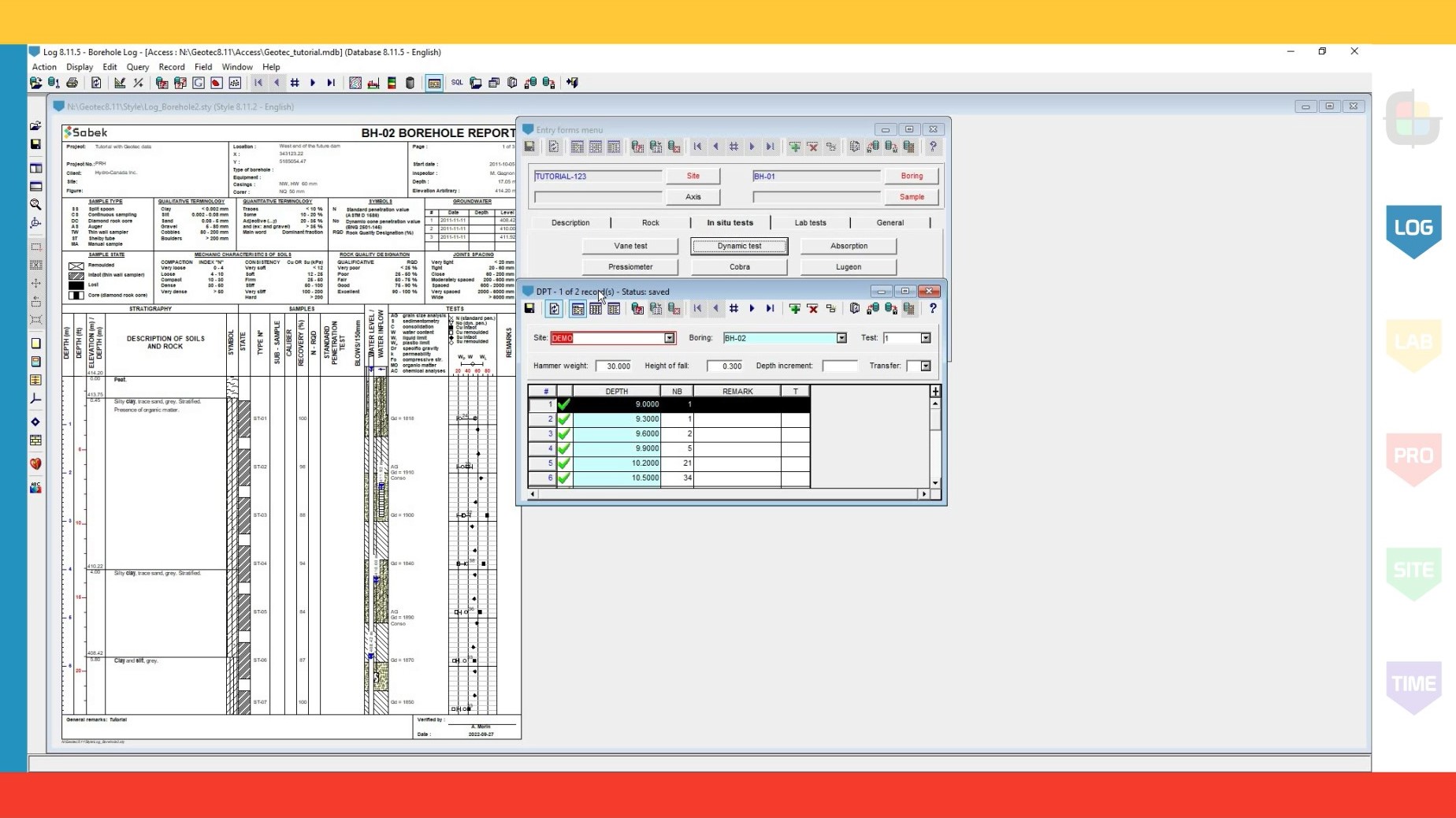
Introduction to Log
Duration – 6:00
Describes the basic functionalities of the Log module for the production of borehole reports.
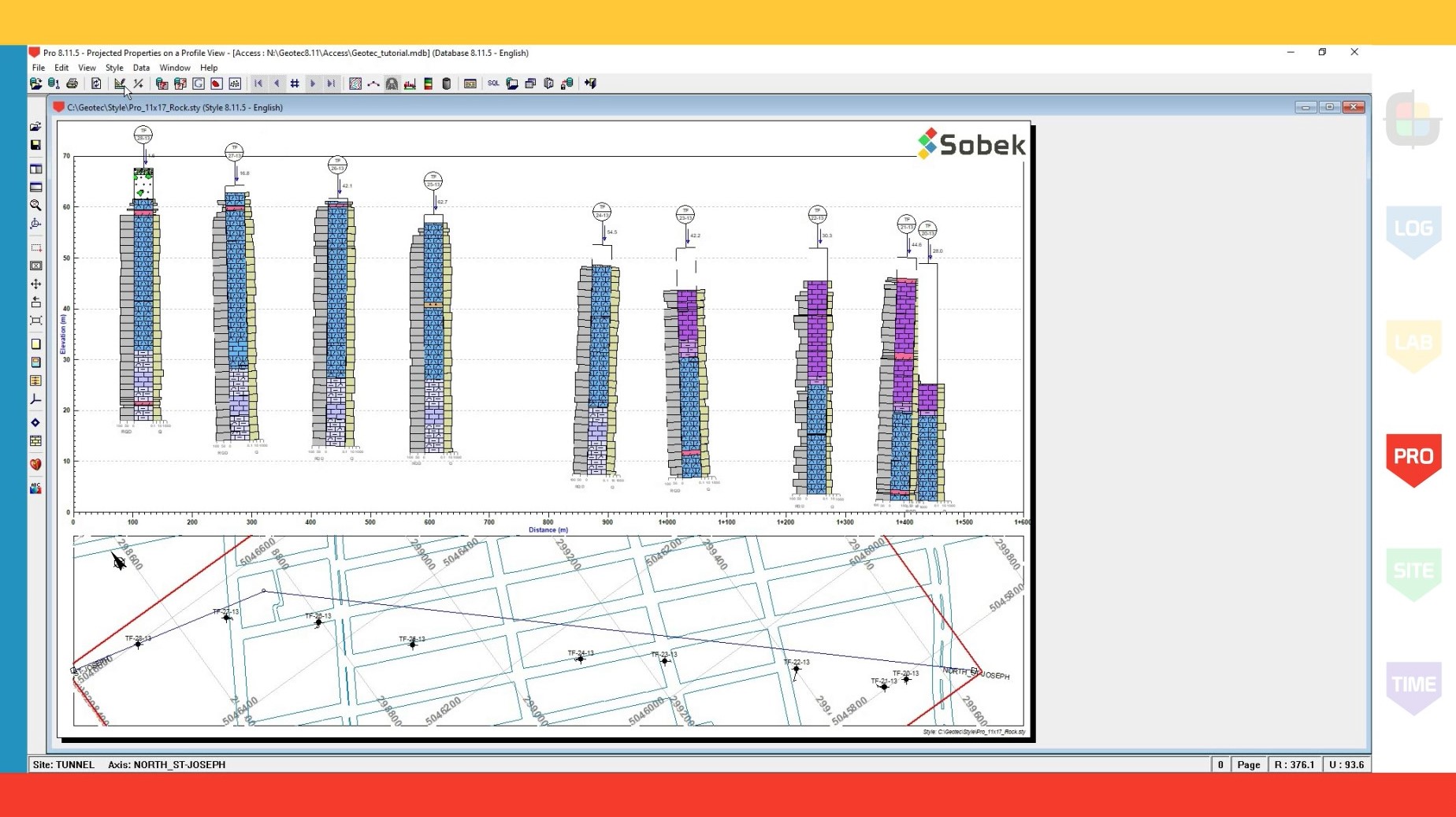
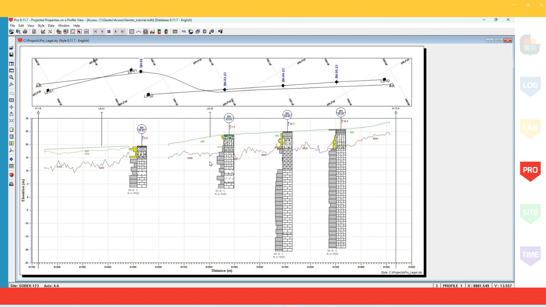
Introduction to Pro
Duration – 5:32
Describes the basic functionalities of the Pro module for the production of cross-sections, including the creation of the axis and the options for the visual report.
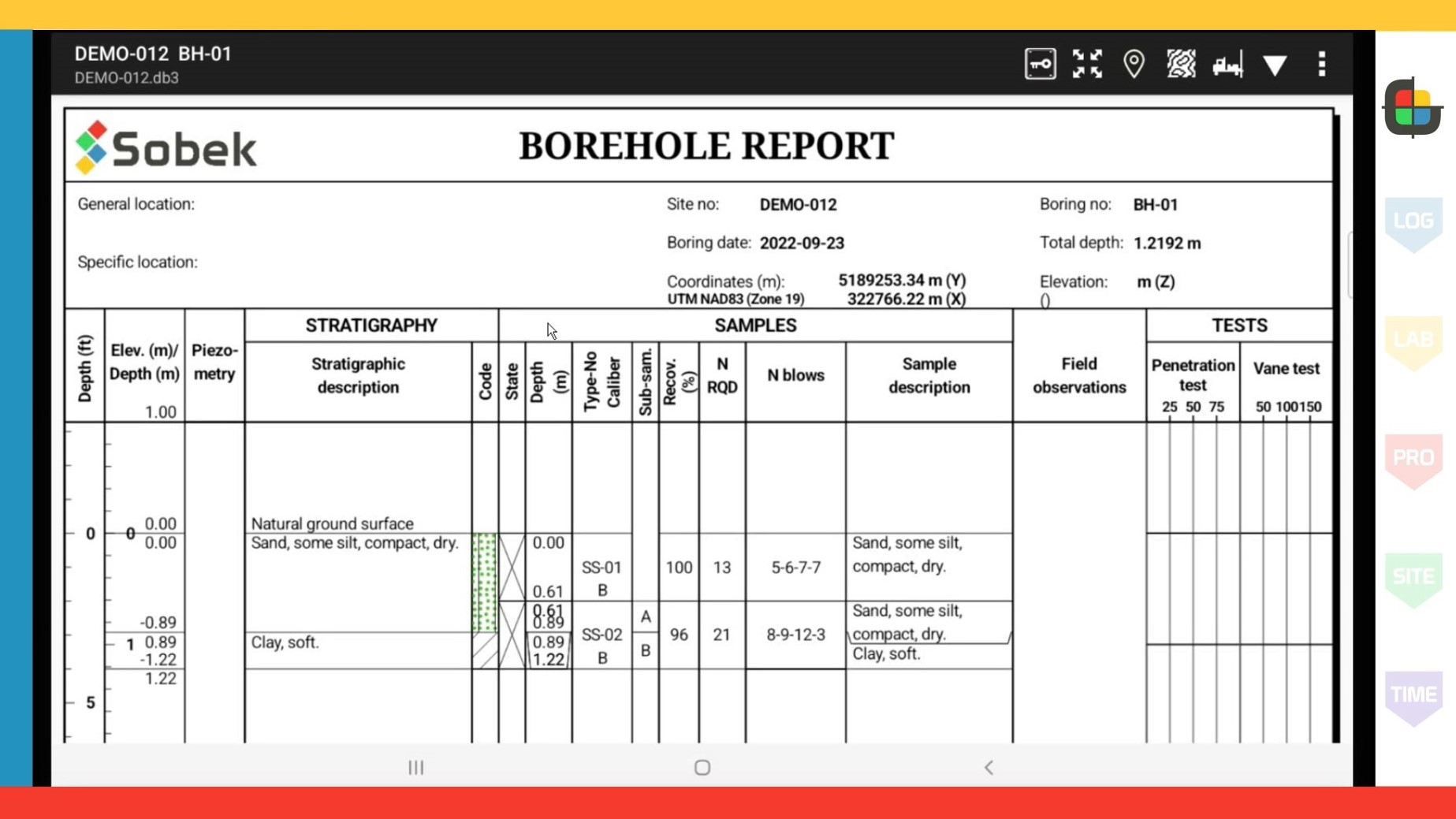
Introduction to Geotab
Duration – 7:31
Describes the basic functionalities of the Geotab application for borehole data entry on the field.
Tutorials
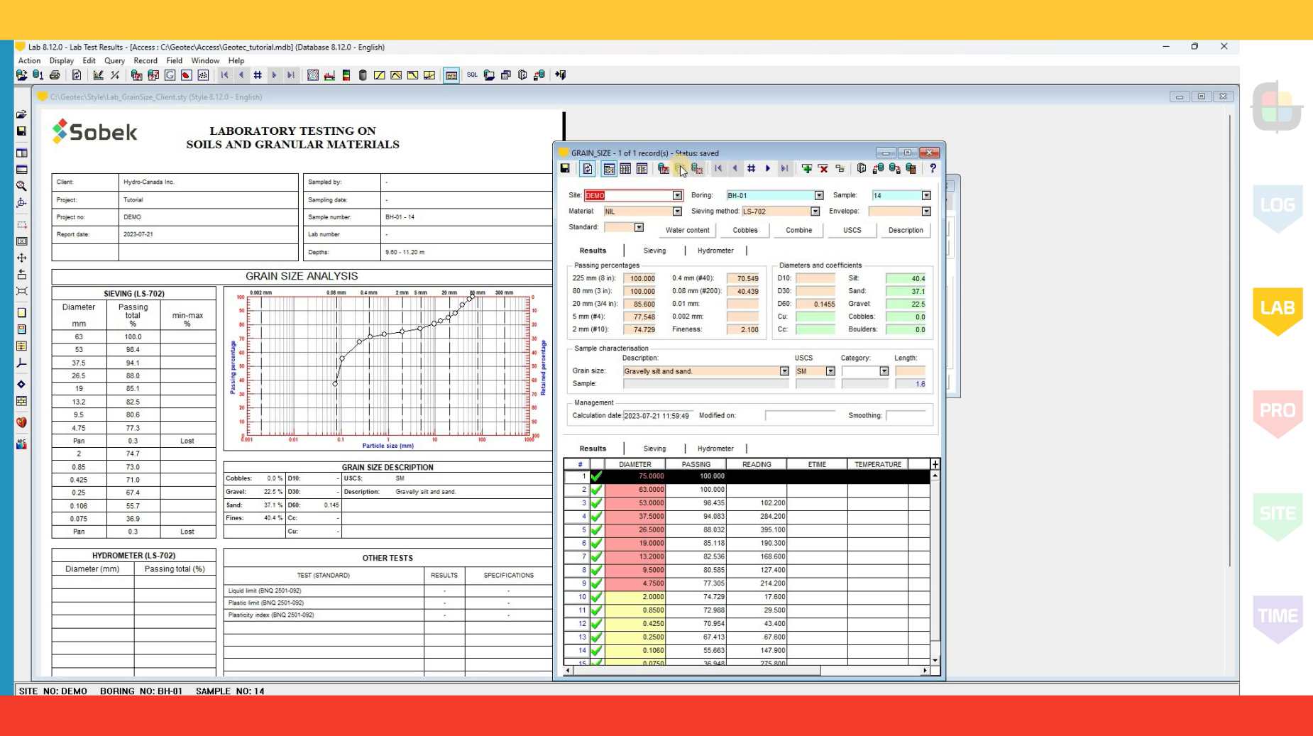
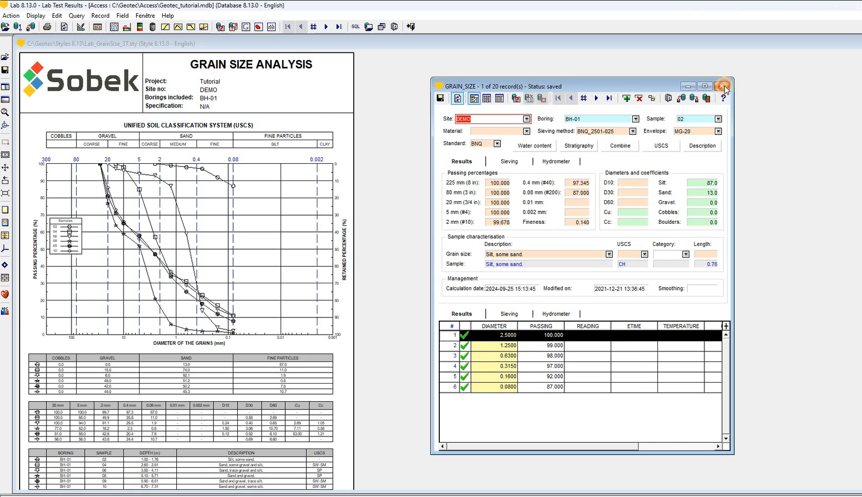
Adding a grain size analysis in Geotec
Duration – 5:33
Explains how to define sieving methods in Geotec and how to add measurements from a grain size analysis done in the laboratory.
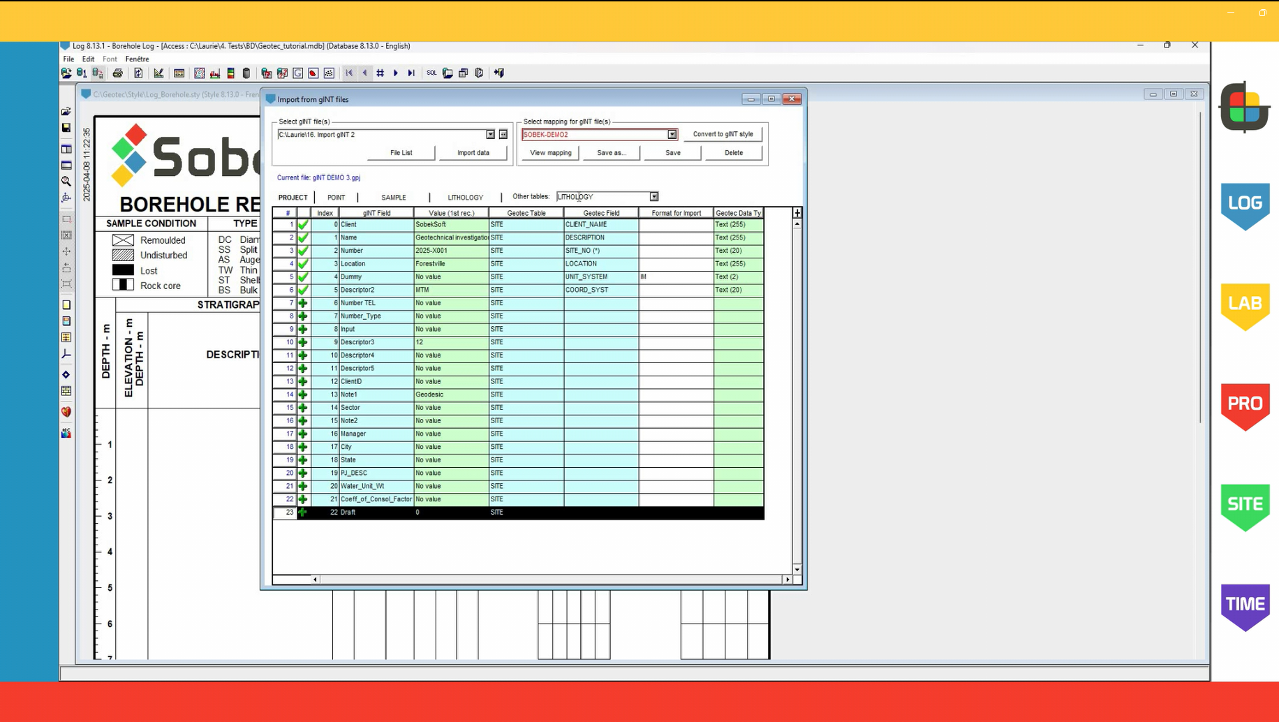
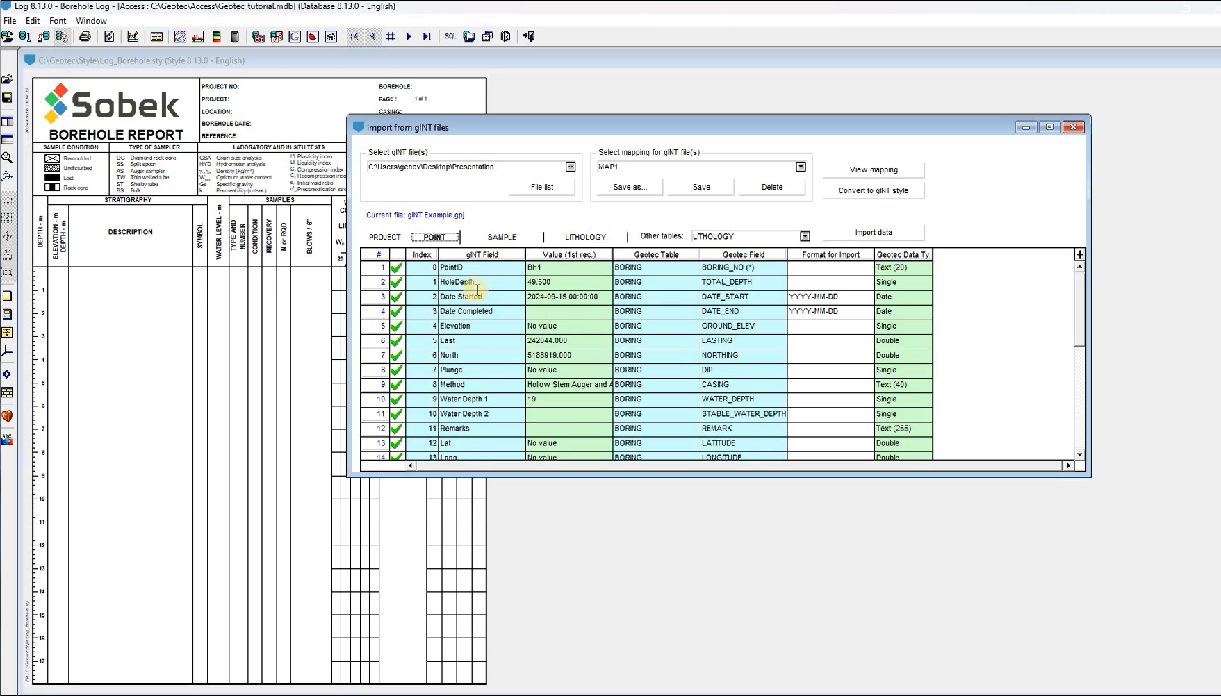
Import of gINT projects
Duration – 4:52
Explains how to import gINT data from your .gpj files in Geotec in order to centralize all your geotechnical and environmental information in your corporate database.
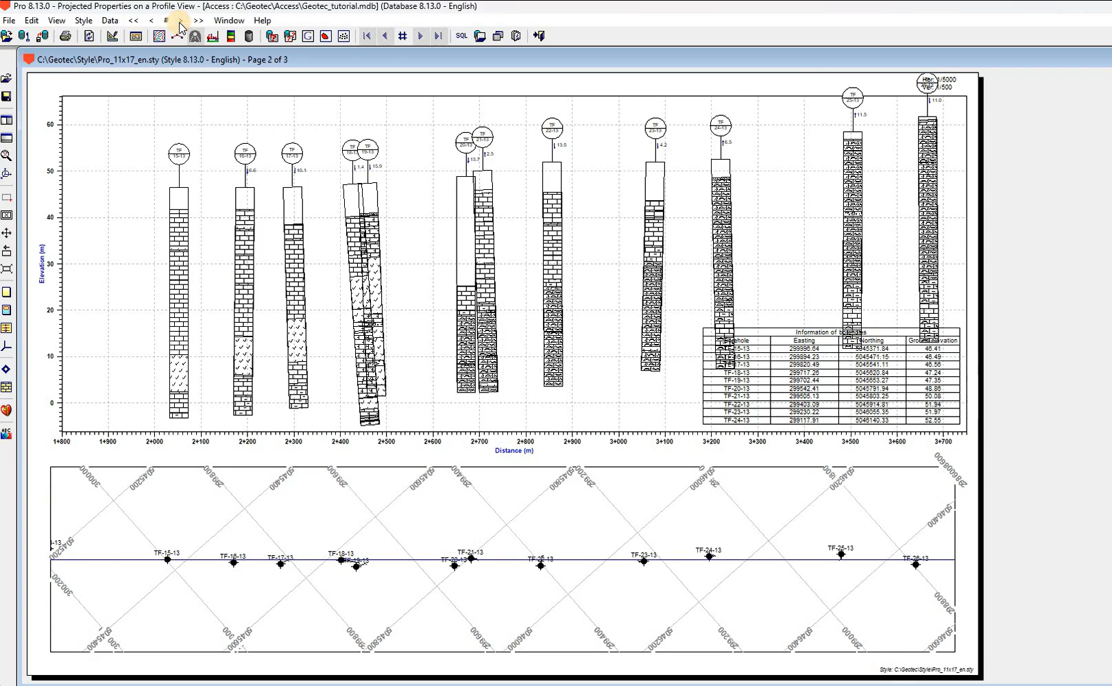
Projection of seismic lines in Pro
Duration – 4:35
Presents a feature in the Pro module to project seismic line data onto profile views.
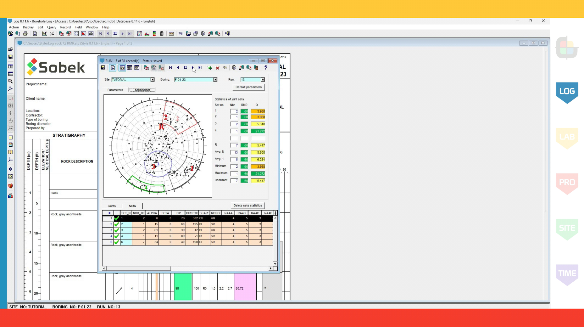
Rock mechanics
Duration – 4:35
Describes the quantitative calculations for rock mechanics integrated in Geotec.
New Feature Highlights
Geotec 8.13: New options in Lab
Duration – 0:46
Presents new options to generate multiple page reports in Lab with grouping samples by site or boring.
Geotec 8.13: Import of gINT data files
Duration – 0:43
Presents the new feature to import gINT projects into Geotec.
Geotec 8.13: Automatic scaling and creation of profiles in Pro
Duration – 0:59
Describes new options for automatic dimensioning of profile views with fixed horizontal scale and vertical distortion – as well as creation of profiles with the mouse.
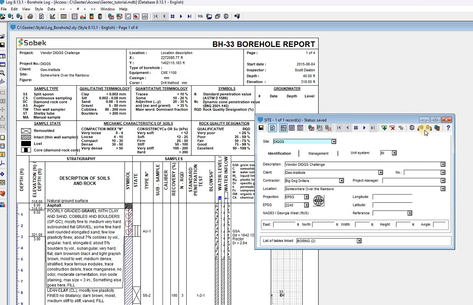
Geotec 8.13.1: Diggs import and EPSG projection
Duration – 0:59
Presents a new feature to import DIGGS file and the use of the EPSG projection system for coordinates.
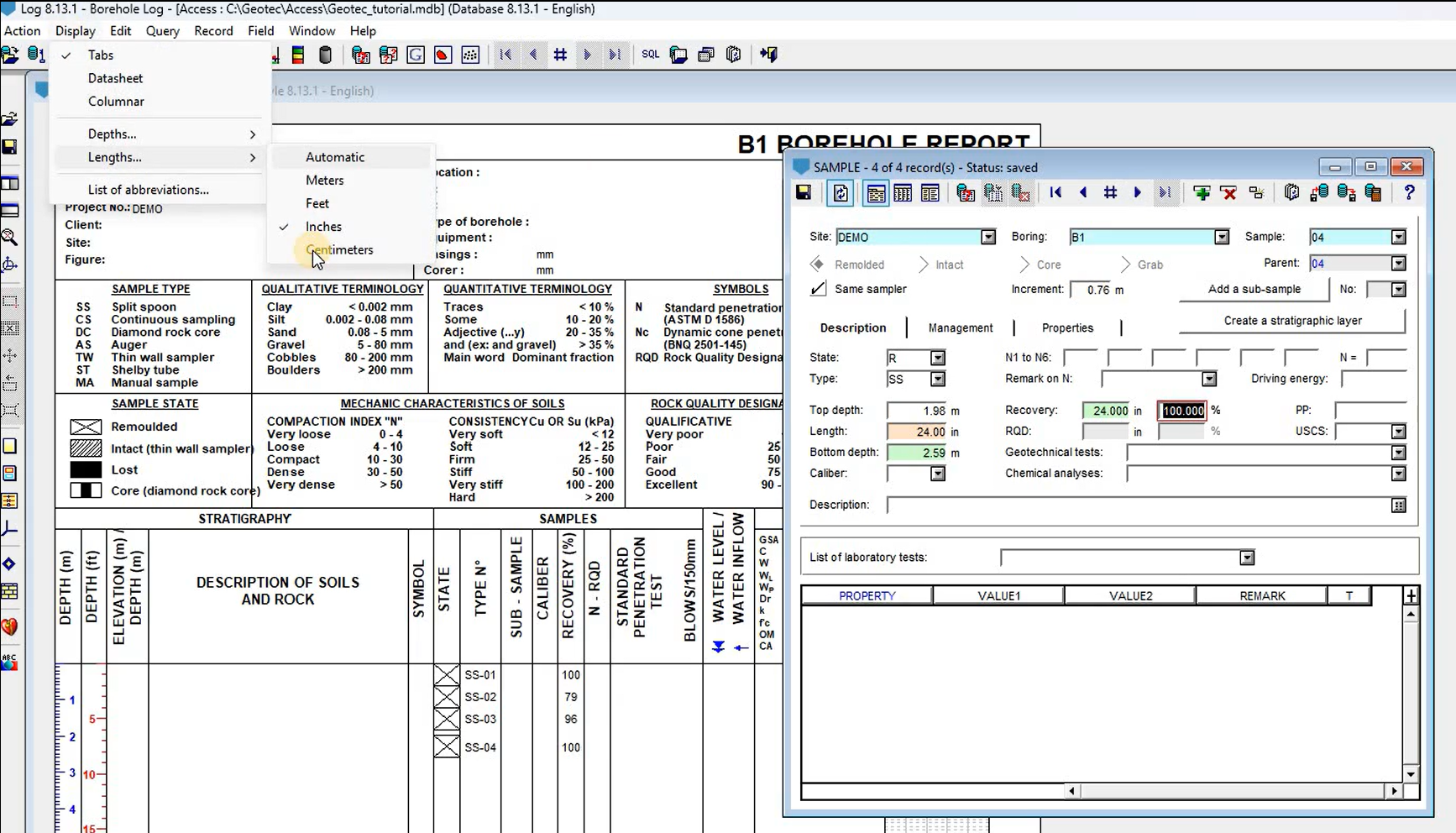
Geotec 8.13.1: Unit system for input
Duration – 0:37
Presents the entry and display of depths and lengths using the imperial or metric system.
Licensing
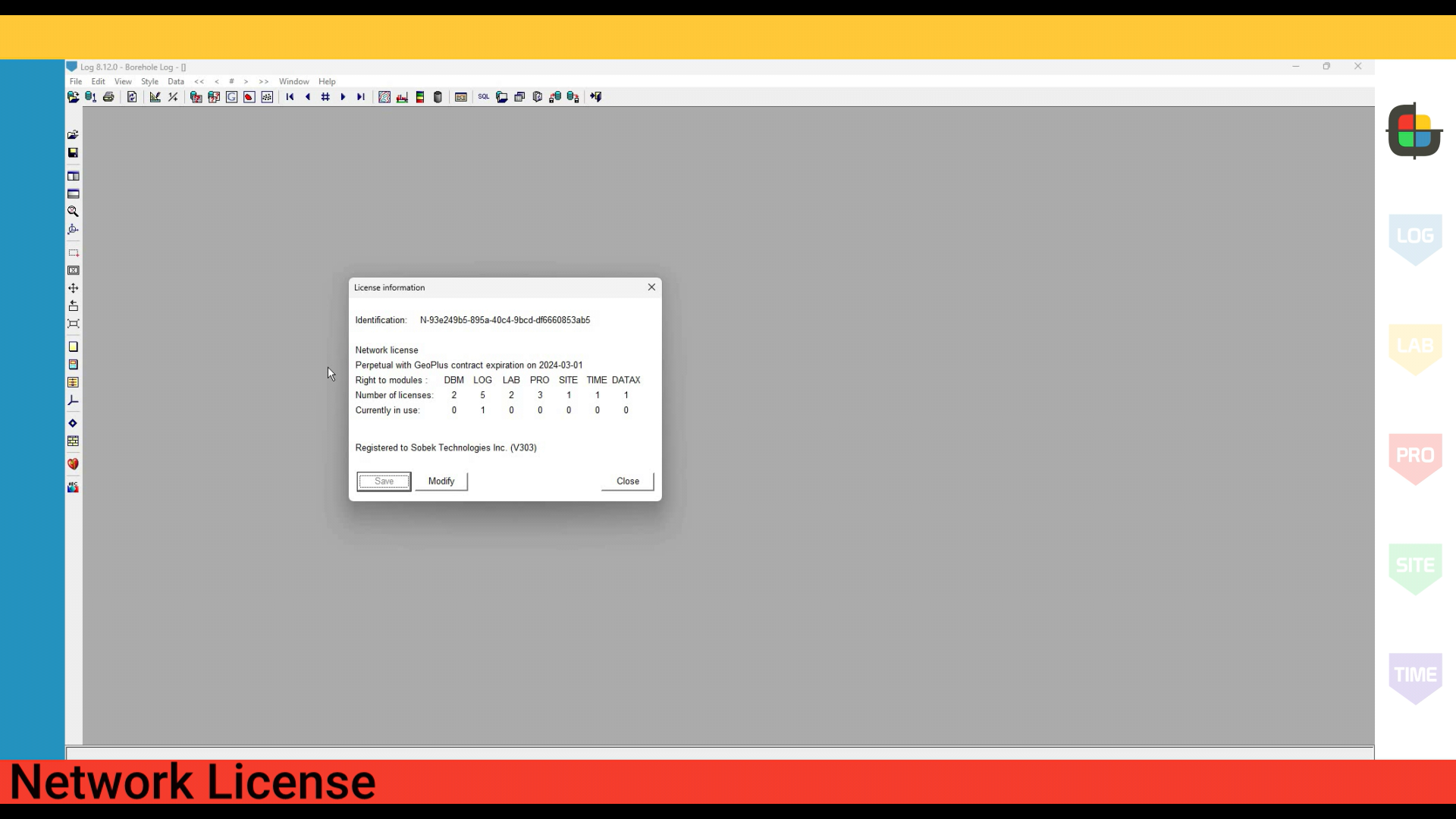
License Activation
Duration – 4:53
Presents the activation of a Geotec license.
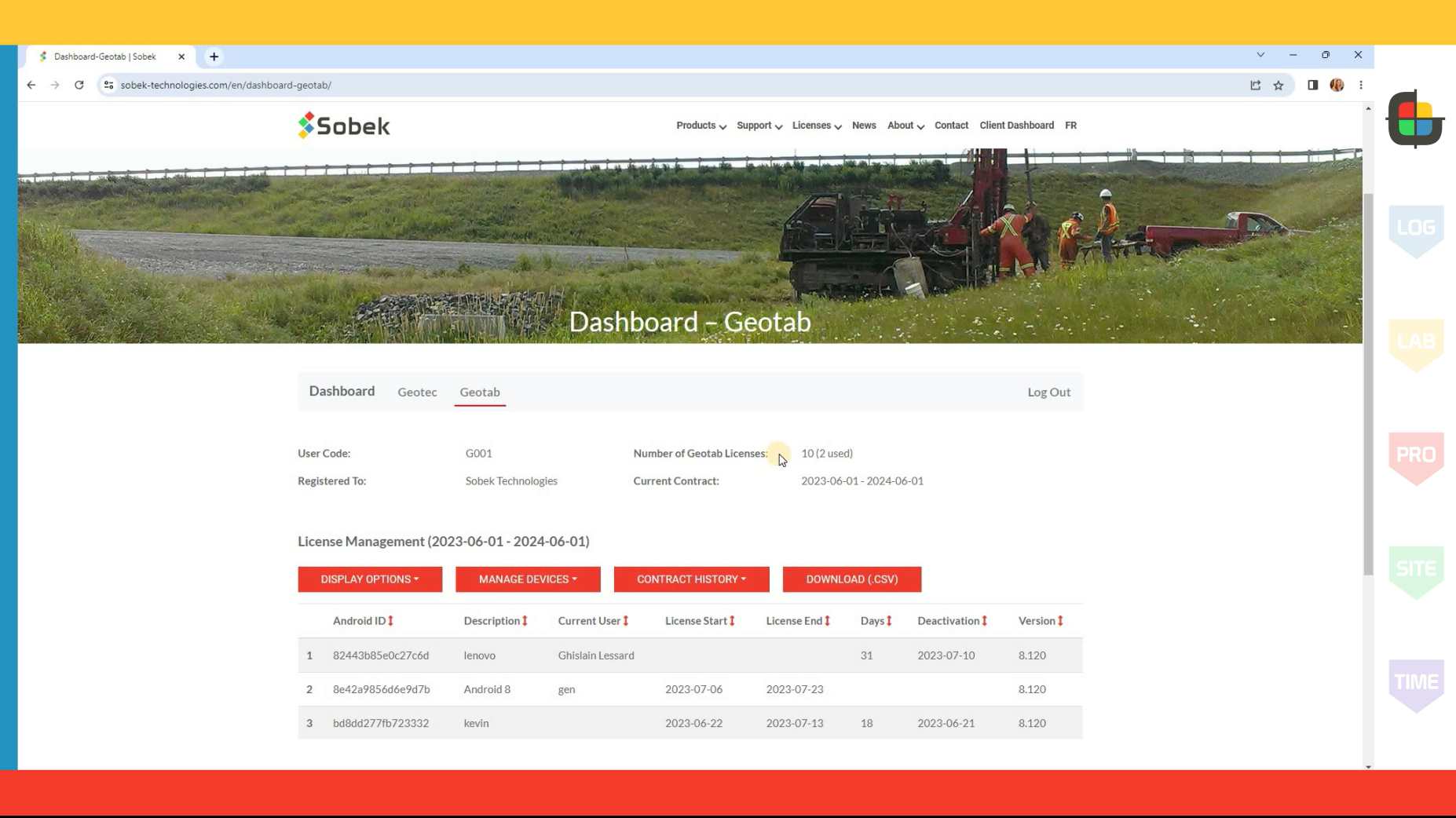
Client Dashboard
Duration – 2:50
Presents the Client Dashboard on Sobek’s website for management of Geotec and Geotab license information at any time.