What is permafrost?
Permafrost is soil, sediment, rock that remains at or below 0°C for at least two consecutive years. It contains varying amounts of ground ice, soil particles, and organic materials, and can extend from less than one meter to several hundred meters below the ground surface.
Why is permafrost important in geotechnical engineering?
When permafrost remains frozen, it can provide a strong and stable foundation. However, when temperatures increase and permafrost thaws, the ground may experience:
- Loss of soil strength
- Settlement and ground deformation
- Instability of foundations, roads, pipelines, and other infrastructure
- Changes in drainage and slope conditions
For engineers working in northern environments, understanding permafrost conditions and ground-ice content is essential for designing resilient infrastructure and monitoring long-term ground behavior. Borehole reports provide a comprehensive record of subsurface conditions and frozen ground characteristics, helping engineers assess and manage permafrost-related risks throughout the life of a project.
How does Geotec support permafrost projects?
As infrastructure development expands across Northern Canada, engineers face unique geotechnical challenges associated with permafrost. Designing on frozen ground requires accurate data, monitoring, and reliable long-term records.
For permafrost projects, Geotec can help engineering teams organize and access information such as borehole data, monitoring installations, ground temperature measurements, and laboratory results within the same geotechnical database.
This can make it easier to:
- Find previous investigation data
- Compare information between monitoring locations
- Reuse existing information for future projects
- Maintain a single, reliable source of geotechnical information
Input Data
Geotec supports specialized permafrost information, including:
- Ice phase classification
- Visible ice content
- Thermal state
- Permafrost zone
- Cryostructure
- Ice lenses
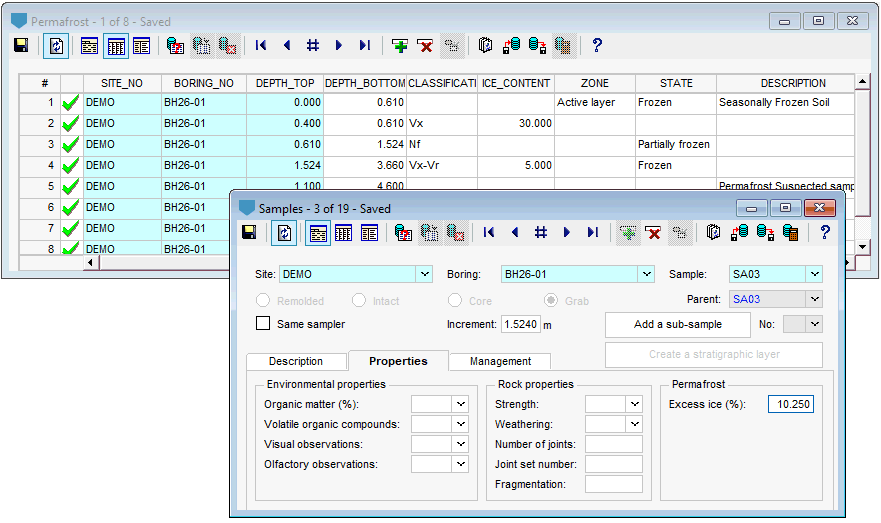
This information is recorded as a function of depth, providing a detailed representation of subsurface conditions throughout the borehole.
The depth of thaw, excess ice content measured from samples, and thermistor installations can also be recorded, with each sensor clearly located by depth.
Graphic reports in Log and Pro
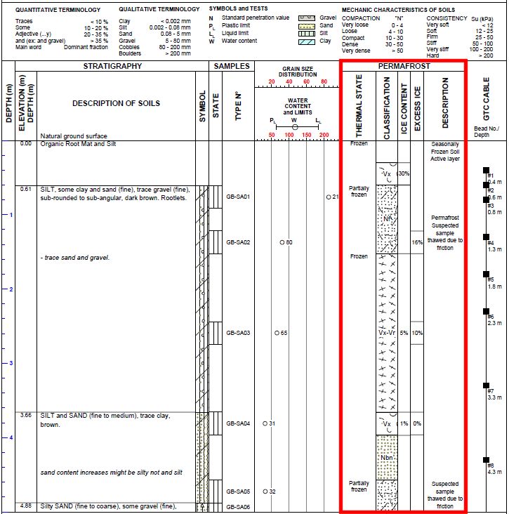
As with all borehole logs, permafrost-related data can be incorporated into customized graphic reports using the Log module. A style file can be configured to display the information most relevant to permafrost investigations, including permafrost conditions, thaw depth, sample test results, and thermistor installations. Each type of data can be assigned its own column and position, text or graphic representation, scale and line style, if relevant.
With the Pro module, the same permafrost information can be presented in cross-sections, allowing engineers to visualize, in a single view, the variation of permafrost conditions, thaw depth, and other subsurface characteristics from multiple boreholes.
Once configured, these style files can be reused for all projects, providing a consistent way to present and communicate permafrost investigation and monitoring results.
How does Geotec make a difference?
With Geotec, permafrost data, subsurface conditions, and thermistor installations are organized within your centralized geotechnical database, making the information easy to query, review, analyze and share. The data can be presented in customizable borehole logs and cross-sections, and exported to formats such as PDF and AutoCAD DXF for easy communication with project teams and clients.